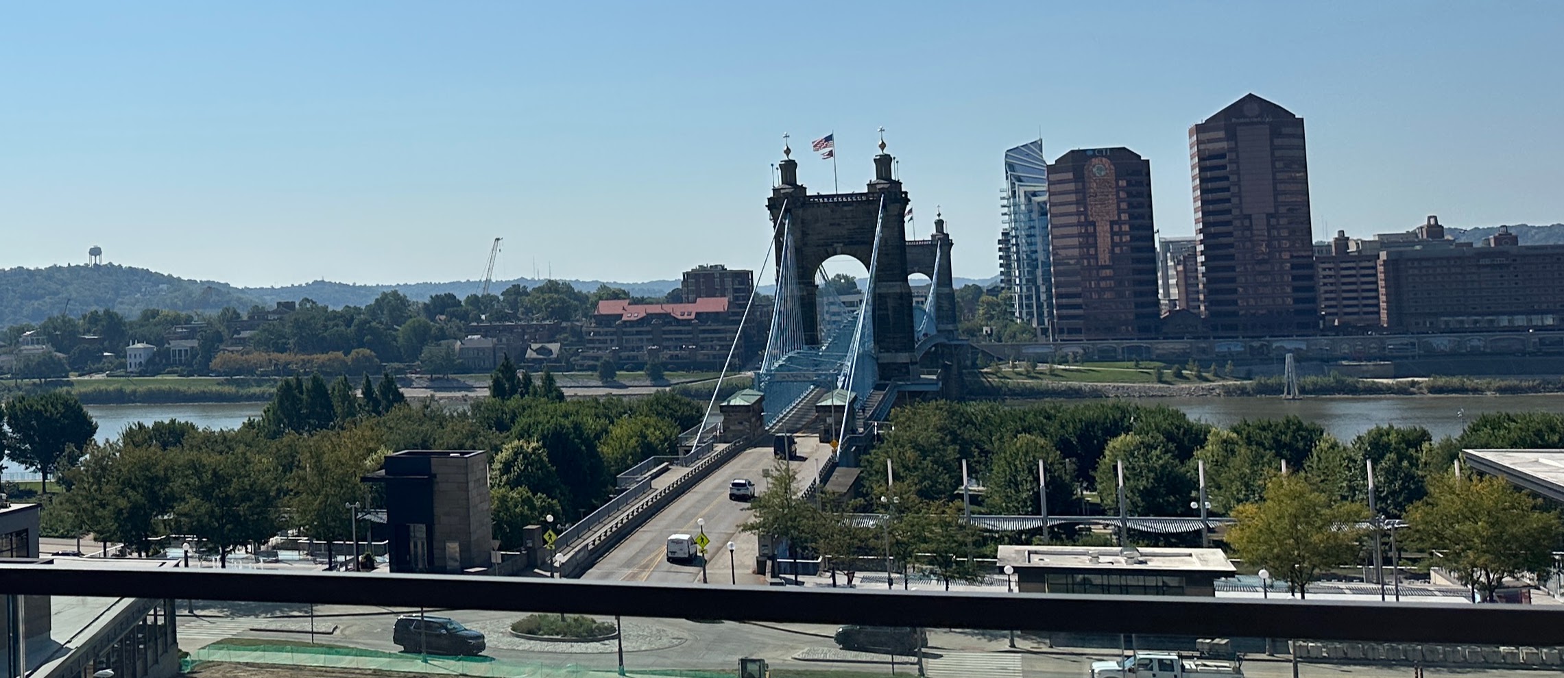
We went to Cincinnati for a few days, with hopes of learning more about America’s ceramics history, going to a Reds game, having a “cheese coney,” eating goetta (thanks to our daughter-in-law and her Cincinnati-born mom for introducing us) and Graeter’s ice cream. We also planned to visit the Underground Railroad museum and the City of Cincinnati Museum, especially searching for the stories of the Fossett family, enslaved at Monticello and subsequently significant members of Cincinnati society.
We were able to do most of those, but were thwarted in some, and added in a few others that we hadn’t planned. The big impediment to enjoying the Queen City was the weather: miserably hot and humid, which made walking around unpleasant and seemed to have kept all the city’s residents indoors, giving a deserted air to signature neighborhoods like Over The Rhine and the riverfront. We did discover a quirky and fun (and, crucially, air conditioned) place, the American Sign Museum, which was a sort of lighted-up history of American commerce, and we took more Ubers to get around than we ever do otherwise, to keep from melting down.
One evening, after we had gone to the National Underground Railroad Freedom Center during the day, we walked across the Ohio River to Covington, KY. Although we had been told that Covington is the center of the pornographic film industry in the U.S. and pondered for a minute how THAT fits into the American story, we had also been told that it is a charming city, fun to walk around, which it is, or would be, if it weren’t 100 degrees and 100 percent humidity. We did have a great dinner there and as we walked back across the river, we were both struck by something unexpected.
We had learned how the Ohio River was so significant to the story of those trying to get from the slave South to the free North in the years before the Emancipation Proclamation, but the physical reality of that boundary came home to us, even though we were able to traverse it on a bridge and didn’t have to try to swim or row across it as enslaved people had once had to do. Standing on the Kentucky side of the Ohio and looking across the less than a quarter of a mile to Cincinnati, it was striking how something as innocuous as a peaceful river could have been the divide between someone’s life as a chattel slave and the hope of a life of one’s own making. The very fact that a person could be a slave on one side of the river and free on the other is an astounding part of the American story. Where else has there been, within one country, such an existential chasm?
It is important to note that, especially after the passage of the Fugitive Slave Act of 1850, even getting across the Ohio was no guarantee of safety or freedom. Bounty hunters, vigilantes, and regular citizens might restrain someone they thought was an escaped slave, in order to return them to bondage back across the river, either for a reward, or simply to obey the federal law. Many who were aided in escaping by the Underground Railroad knew they weren’t truly safe until they crossed another border, the one that took them into Canada, where slavery was illegal everywhere. Until we were there, we didn’t realize how Cincinnati has long been, as text at the Underground Railroad Museum says, “a borderland–between north and south, east and west, free and unfree…a unique place to explore our nation’s history.”
Boundaries and dividing lines have always mattered in the American story, even ones that exist only on paper and aren’t as tangible as the Ohio River. In traveling this year, even without crossing international boundaries, we have become more aware of dividing lines of all sorts. There are, for example, all those tricky time zones, which are especially problematic in the Midwest, where part of Indiana is on Eastern Time and part on Central Time. We realized this fact as we were driving from Illinois to Michigan to meet up with old friends for dinner; sending a text that starts with “we just figured out we are going to lose an hour” is not a great way to begin renewing a relationship.
State lines, too, are invisible but important: after the “welcome to” sign, you realize the highway graphics look different, sometimes the available roadside services change abruptly (wait, there are only a few Wawas in Ohio?), your toll transponder may not work any more, and in some cases the whole look of the place changes suddenly (think of going into West Virginia from any of its adjoining states).
The boundaries of voting districts, that crazy American phenomenon, are notoriously often irrationally shaped, but they matter so much that politicians of all stripes vie to control those squiggly lines on a map.
Sometimes a border is as local as two sides of one street. Richmond, VA’s Broad Street is a thoroughfare that divides races, economic strata, and, relatedly, school districts. In the 1980s, the north side of Broad Street was Black and the south side white, a situation so entrenched and problematic that they built a shopping mall in the form of a literal bridge over the street to try to bring about a more unified city. Sixth Street Marketplace, as I well remember, opened to great fanfare but never succeeded in its mission before it was largely demolished in 2003.
Railroad tracks often stereotypically (but nonetheless actually) divide towns into zones that most people recognize subliminally even if they never use the phrase “other side of the tracks.”
A key dividing line in American history is the Mason-Dixon Line, which was commissioned in the 18th century to delineate colonial boundaries, but then became the border between the states of the Union and the Confederacy in the Civil War and still is a shorthand for the place where the North abruptly becomes the South and vice versa. So even though it’s just a line on a map and not a physical presence, it has real-world consequences and creates actual identities, like many other geographic boundaries do. I was naively unaware of the reality of the Mason-Dixon Line’s continuing relevance even as late as 1975, when I went to college in Virginia from Illinois. Conversations with new friends from the South let me know that some came from homes where the Civil War was The War of Northern Aggression, and my familiar hero Abe Lincoln was considered an ignorant rabble-rouser…and those were some of the less concerning of the beliefs held below the line that I hadn’t thought about since it was a question on my middle school history test. I also learned marvelous Southern expressions like “she’s as nervous as a long-tailed cat on a porch full of rocking chairs,” heard gorgeous songs like “I’ll Fly Away,” and ate deviled eggs with the magic ingredient of sugar that made them soar. Below the Mason-Dixon Line was different from above it, in so many ways. I think in some ways it still is, but America today lives with more of a Red/Blue divide than a North/South one.
The area around Cincinnati is sometimes called the Borderlands–as the terminus of the Underground Railroad, a story of borders, divides, and boundaries, and what it took to get past those borders when it mattered. In 1848, Alexis de Tocqueville, the great outsider chronicler of the American scene commented that “the traveller who floats down the current of the Ohio…may be said to sail between liberty and servitude…,” a situation that inevitably led to confrontations, violence, and divisions. There was the courage and determination of enslaved and formerly enslaved people in getting themselves to a place of freedom, including choices that involved leaving loved ones and stepping into a brutal unknown. Famous people like Harriet Tubman who, once safely across the Mason-Dixon Line, risked everything to go back across it to rescue others, but also a half-million people whose names and stories we may never know, who made their way through what became the Underground Railroad to varying degrees of a better life.
And it came home to us that there were also countless free Black and white people who risked their own lives and fortunes to help those trying to escape; it was dangerous for them as well, and the consequences could be terrible, but they did it because they knew it was right. John Rankin, an outspoken abolitionist, built a house high above the Ohio River from which he and his family aided in the escape of hundreds of enslaved people, often in the face of violence and harassment. Levi Coffin and his wife Catharine assisted thousands from their homes in Indiana and Cincinnati, as well as supporting the production and sale of free-labor goods, an early example of fair trade commerce. Peter Fossett, enslaved by Thomas Jefferson and sold on an auction block to help pay the debts of Jefferson’s estate in 1826, made his way eventually to Cincinnati and became a caterer, minister, and part of the Underground Railroad. We had thought he might be featured all over Cincinnati history, but it turns out that his story, no matter how astonishing, is but one of many that include bigger names, like Harriet Beecher Stowe, William Lloyd Garrison, and Frederick Douglass.
On one of our Uber trips in Cincinnati, we were chatting with our young Black driver about the Underground Railroad Museum, when he enthusiastically said that he had recently taken his kids there. “I wanted,” he said, “to show them that some white people risked everything to help people like us. They weren’t all out to get us, and I want my kids to know that.”
We may think that because we live in a global world where the only realities are digital, boundaries and dividing lines are merely historical footnotes, but traveling the U.S. this year has made me realize they can be very current. I must admit that, while visiting Detroit, a week or so after Cincinnati, I glanced across the relatively narrow strait that separated us from Canada, and had a quick moment of calculating whether I could swim that distance, and deciding what my new Canadian name and identity would be. I am in no way comparing myself to the dire circumstance of an enslaved person standing on the south bank of the Ohio River in the mid-nineteenth century and looking northward toward freedom. But as we all know, boundaries matter, and some are becoming more important every day.

Roebling cut his teeth on bridge-building in Cincinnati before he tried the big one in Brooklyn 
A cluster of museums in the spectacular Art Deco Union Terminal 
Birds by Charley Harper, one of the examples of great public art in the city 
The American Sign Museum–just one of many great small attractions across this country 
Inside the sign museum 
Our 3000-square-foot, trying-hard-to-be-hip, loft apartment, complete with rooftop terrace which was even more baking than street level and thus got no use by us 
Goetta (“getta”), which I promise tastes better than it looks
Leave a Reply