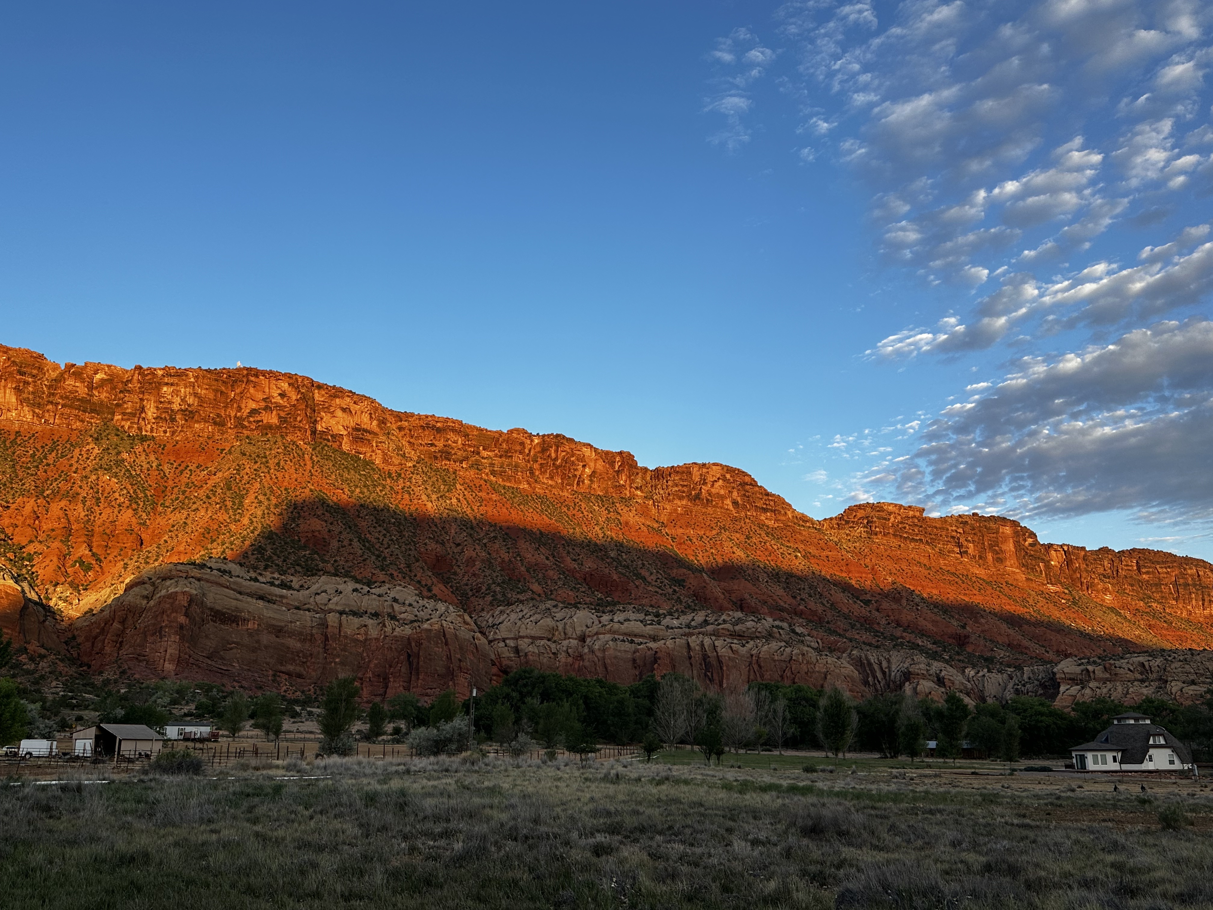
Driving from Colorado into Utah took us through Leadville, a funky little high country town, then onto I-70, perhaps the most desolate stretch of road we have ever seen. With a speed limit of 80 mph, the salt flats and low hills thankfully went by quickly. Turning onto Rte. 128 toward Moab, the scenery became distinctively Utah: scrubby plains, mountain passes, canyons, buttes, and lots of red rock formations. Utah’s geology is probably the most complex and varied in our country, and the conserved open spaces in Utah showcase this deep-time complexity in stunning fashion.
Over eight days, we visited Arches, Canyonlands, Capitol Reef, and Bryce Canyon National Parks, and Goblin Valley, Anasazi, and Antelope Island State Parks, and while there are similarities between the parks, each has unique qualities. As is our usual practice, we stopped in the Visitor Center at each for context and conversation. The beautifully produced films in each center described how water, wind, and time interacted to create places almost beyond description. As a result, we decided to let the places speak for themselves, with minimum commentary. Our hope is that you might experience some of the beauty and character of each park just as we did. Enjoy!
Arches National Park (Dianne)

Arches is what this park is all about…over 2000 of them packed in a relatively small NP. The range of shapes and sizes shows that stone is not, in fact, solid and unchanging. The fins of stone were thrust up by tectonic forces over millennia. Rain (rare but powerful) and wind are constantly scultping the soft sandstone; come back in a few years and new arches will have formed and existing ones fallen.
This is Windows (or Spectacle) Arch—note the “nose” between the eye openings.

Landscape Arch, a slender thread of stone, the longest natural arch in North America. This one just appears around a bend in the path, not showing off but waiting to be found.

Some trails are marked only by rock cairns. How to tell what is a marker and what is a natural pile of rocks? That is what makes it a challenge! Note the “Three Gossips” on the left side.

My favorite, Double Arch, featuring complex positive/negative relationships with red stone framing blue sky and green landscape. Note the people in this photo for scale.
Canyonlands National Park (Joey)

Canyonlands has canyons half as deep but twice as wide as the Grand Canyon, so the park is ENORMOUS! You spend nearly all of your time at the top looking out and down at the amazing canyons created by water cutting through the rock over hundreds of thousands, perhaps millions, of years. Water is a powerful force over time.

Of course, there were arches at Canyonlands also, but not nearly as many as in Arches. The real treat was the view below this arch–see the next photo.

I stood under the arch, perhaps a little too close to the edge, looking down. I can’t begin to estimate how far down the canyon floor is or how far out I could see, but both distances were staggering.

I walked over rock, along ledges, up and over piles, and ultimately reached the Grand View Lookout at the park. With about a 270-degree view, it was indeed grand, looking out at miles and miles of natural, undeveloped, and mostly untouched land. It was certainly one of the best lookouts ever.
Capitol Reef National Park (Dianne)

So the “capitol” part is from this huge whitish formation, which early settlers felt looked like the dome of a certain D.C. landmark…

and the “reef” part is because this area was once an ocean floor (like much of the continent, off and on in geologic history). Among the other forces on display here is the slow but monumental pushing up of earth’s layers, in this case creating a 100-mile-long crease called the Waterpocket Fold, because it has dimples large and small that, if horizontal, collect water. Turns out, the earth has myriad ways it shifts and wiggles and crashes around, and in places like southern Utah, they are on full display.

Capitol Reef was once settled by Mormons, who irrigated and created orchards and lived in complete isolation in this valley. Now, part of that legacy is fruit trees, and every day in this cottage they sell scrumptious little homemade pies. Not your typical National Park concession!

Before any Europeans were here, there were Native people for millenia. One group, which disappeared mysteriously around 1300 CE, left these figures, part of an array of them on a cliff face. We had a wonderful time, along with some German visitors, searching out the petroglyphs (carved into rock; pictographs are painted on). “Look—there’s a flock of sheep! Over there—a bison!” Different cultures’ petroglyphs have distinctive forms, like the inverted triangles for bodies and antenna-like things coming from the heads seen here. The splayed fingers are consistent.
Bryce Canyon National Park (Joey)

Bryce Canyon is like a miniature Grand Canyon but much more accessible and much less overwhelming. Not to say that it’s not breathtaking, though–this is my first view of Bryce Canyon amphitheater after checking into our cabin. Jaw drops….

Bryce Canyon is known for its hoodoos, which are stone formations created by the removal of material by wind and water over thousands of years. In Bryce Canyon, they are everywhere, and rounding each corner provides another amazing assortment of shapes and figures. So much fun to see people and things in the different formations.

We were told that part of experiencing Bryce Canyon was to see if from both the top and bottom. So, being committed to doing as we’re told, I hiked down into the canyon on the Queen’s Garden and the Navajo Loop Trails, a length of about 3 miles altogether. So interesting, being surrounded by hoodoos on trails at times 30 feet wide and other times 4 feet wide. Going down was a delight, coming up not so much. In the photo to the left you can see one of the narrowest parts of the trail with the highest walls. So glad I did it, as Bryce Canyon is unlike any place I have ever been.

Bryce Canyon is beautiful from every angle and fascinating in its geology and formations. Photos can’t really capture the details, but I hope they give you a sense of the essence of the place.
Goblin Valley State Park (Dianne)

Down a long road through sagebush and little else, was this tiny valley full of rounded, blobby stone toadstools, sea creatures, and yes, goblins, made by Mother Nature seemingly purely for delight. It was hot wandering among them, but fun to see what treasures awaited.

Puppy face, maybe?

Sleeping bunny? Wrinkly old man with a big nose?

Astonishing how light on red rocks can be so endlessly fascinating.
Anasazi State Park (Joey)

This small state park is like a stone being slowly cut and shaped into a gem. Sitting primarily on an archaeological site shrouded in mystery, the park now focuses its attention on a Hopi ancestral people who lived here approximately 1300 years ago, but then left for unknown reasons. The park struggles with inadequate funding and slow approval processes in working with state and Hopi cultural review teams, but they are making progress in telling its story. We had a wonderful conversation with several staff there and their commitment, knowledge, and cultural sensitivity were inspirational.

The site is an archeological dig over many decades and reveals complex building design and construction techniques. Foundations have been uncovered to show multiple storage and living spaces all interconnected and weather-proof.

This is the largest structure still standing. The building materials are a combination of adobe and stone, and there are several types of openings in some of the spaces. The architecture goes far beyond what I picture for a people living so long ago, showing how little I know and how advanced Native Americans were centuries before America was “discovered.”
Antelope State Park (Dianne)

Outside of Salt Lake City and in the lake itself, is this vast island set aside as a wildlife refuge, an otherworldly mix of briny water, bleached shoreline, and windswept hills. The lake is disappearing fast due to drought and industrial overuse. The result is that what looked to Brigham Young like a paradise in 1847 is now an ecosystem in trouble.

Our first bison spotting, part of a large herd protected on Antelope Island.

After walking 1/2 mile across the strangest crusty ground, we got to the water’s edge. Far down the “beach,” a few others were actually wading in, but we were put off by the smell, and the millions of tiny sandflies (all the black areas near Joey’s feet in this photo are hordes of these bugs) so trudged back to the parking area. But how often do you get up to the edge of a huge inland salt water body?
Golden Spike National Historic Site (Joey)

North of Salt Lake City, but really out in the middle of nowhere, is this delightful historic site commemorating the completion of the transcontinental railroad. At Promontory Summit, in 1869, the Union Pacific Railroad connected to the Central Pacific Railroad and essentially connected the east coast to the west coast. America would never be the same.
Replicas of the original two engines were running on the tracks–the Jupiter from the Central Pacific Railroad and No. 119 from the Union Pacific Railroad. Jupiter burned wood for fuel while No. 119 burned coal. They were both beautiful machines.

The golden spike, of course, is long gone, but the site uses a golden colored railroad tie to mark the actual connection point. Engraved on the golden spike: “May God continue the unity of our Country as this Railroad unites the two great Oceans of the world.” The completion of the railroad, followed quickly by other lines to other western locations, marked the beginning of the end of the frontier and a whole new phase of history for the western part of the country.
Utah Accommodations


Leave a Reply